Llyn Peninsula
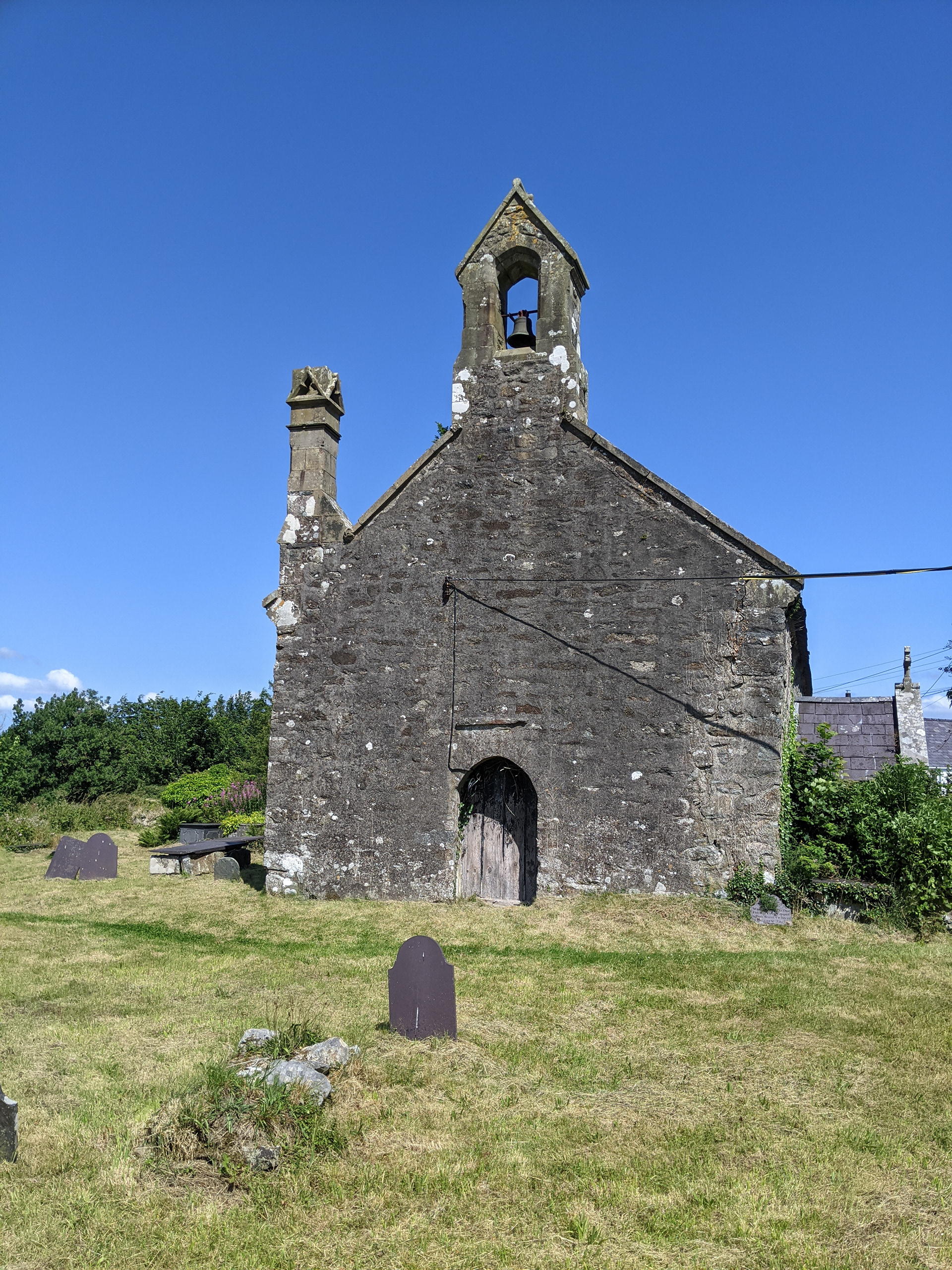
St Cybi’s Church
Right next door to Bryn Aber Bach lies the beautiful Church of St Cybi. Sadly there are currently no regular services at the church and it remains locked most of the time. However the graveyard is accessible from a public footpath that runs from the eastern to western corners. This path continues on through a step and gate to St. Cybi’s Well which is located a few hundred yards behind the church in the little valley below. The church is open from time to time for cleaning and general upkeep and you may be allowed to look inside with permission.
History
The church is dedicated to the six century Cornish saint, Cybi, believed to be an early missionary in these parts, and who is said to have struck a stone nearby causing the effusion of waters that became one of the most famous healing wells of Wales. The nave is medieval, with a late fifteen century chancel. The church was restored in 1879. The churchyard contains the grave of Daffy Owen, (Dew Wen o Elfin) a local poet, one of a number of bards of the area which flourished in the early nineteenth century.
St. Cybi’s Well & Garn Bentyrch
Healing well and Iron Age Hill Fort
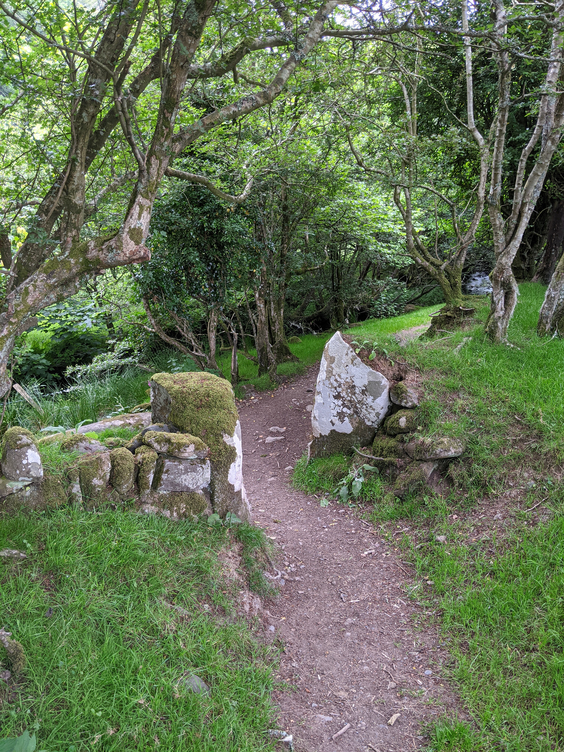
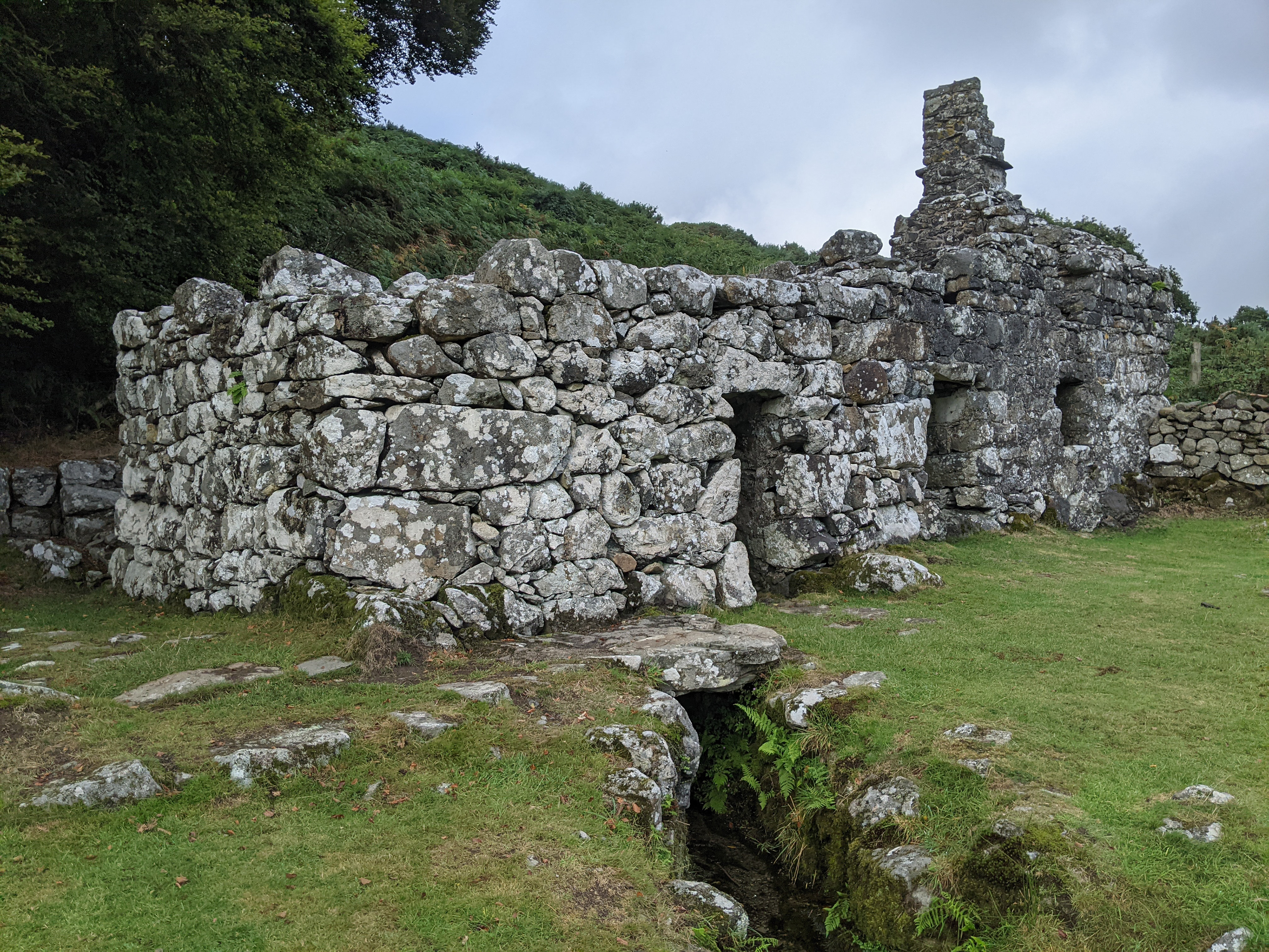
St. Cybi’s Well (Ffynnon Gybi) is a holy well with possible pagan origins. Nestled amid trees in a secluded spot a few hundred yards north of the cottage within the little valley created by the Afon Gybi (River Gybi), this ancient holy site possesses an unmistakable air of magic. Dedicated to Cybi, a 6th-century saint reputed to have lived in the area , the well’s waters have long been believed to hold healing properties.
Today you can see two well chambers alongside a more recent caretaker’s cottage dating from the 18th or 19th century. Despite its association with St Cybi, it’s possible that the well’s sacred status may be pre-Christian in origin.
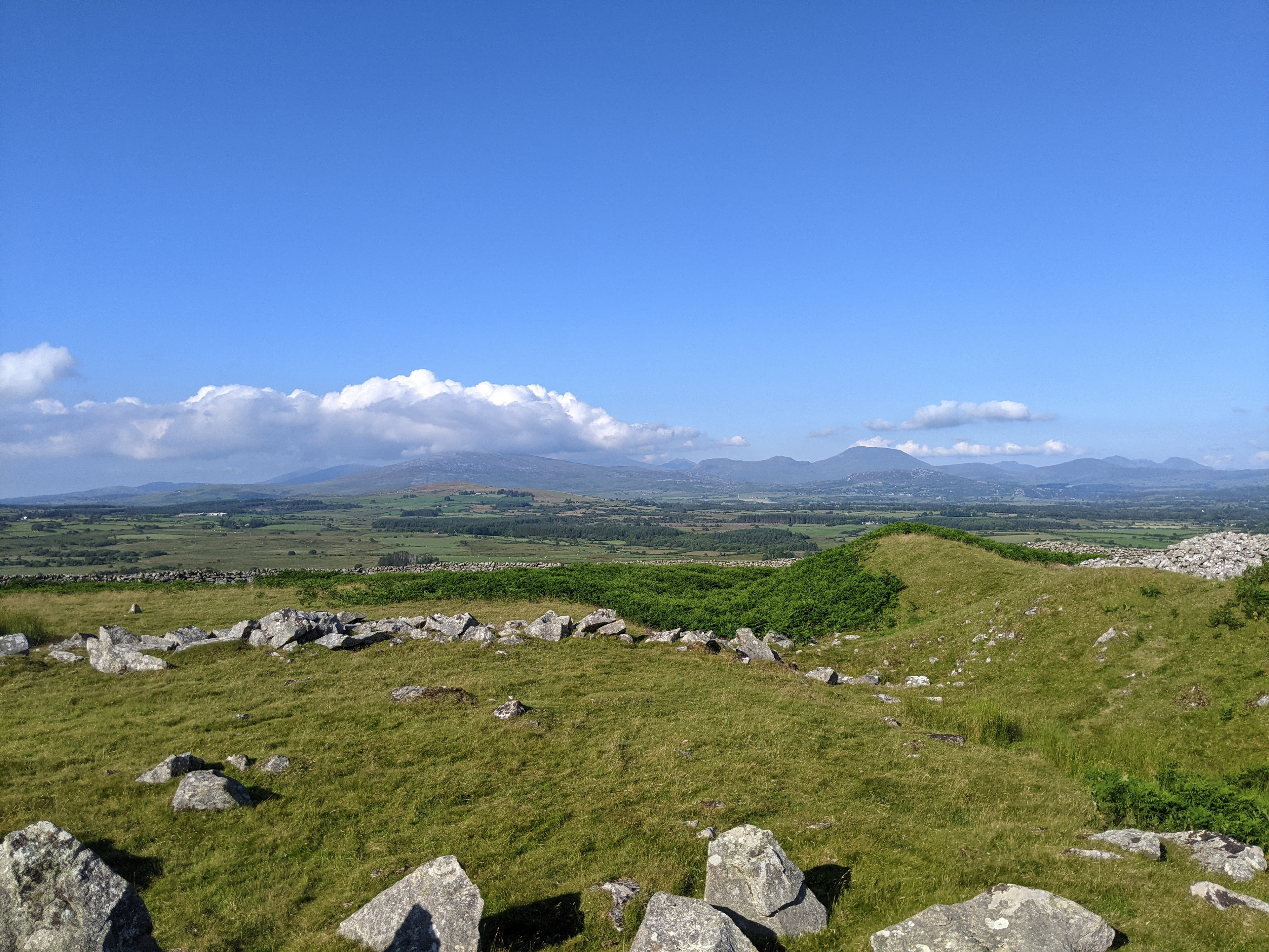
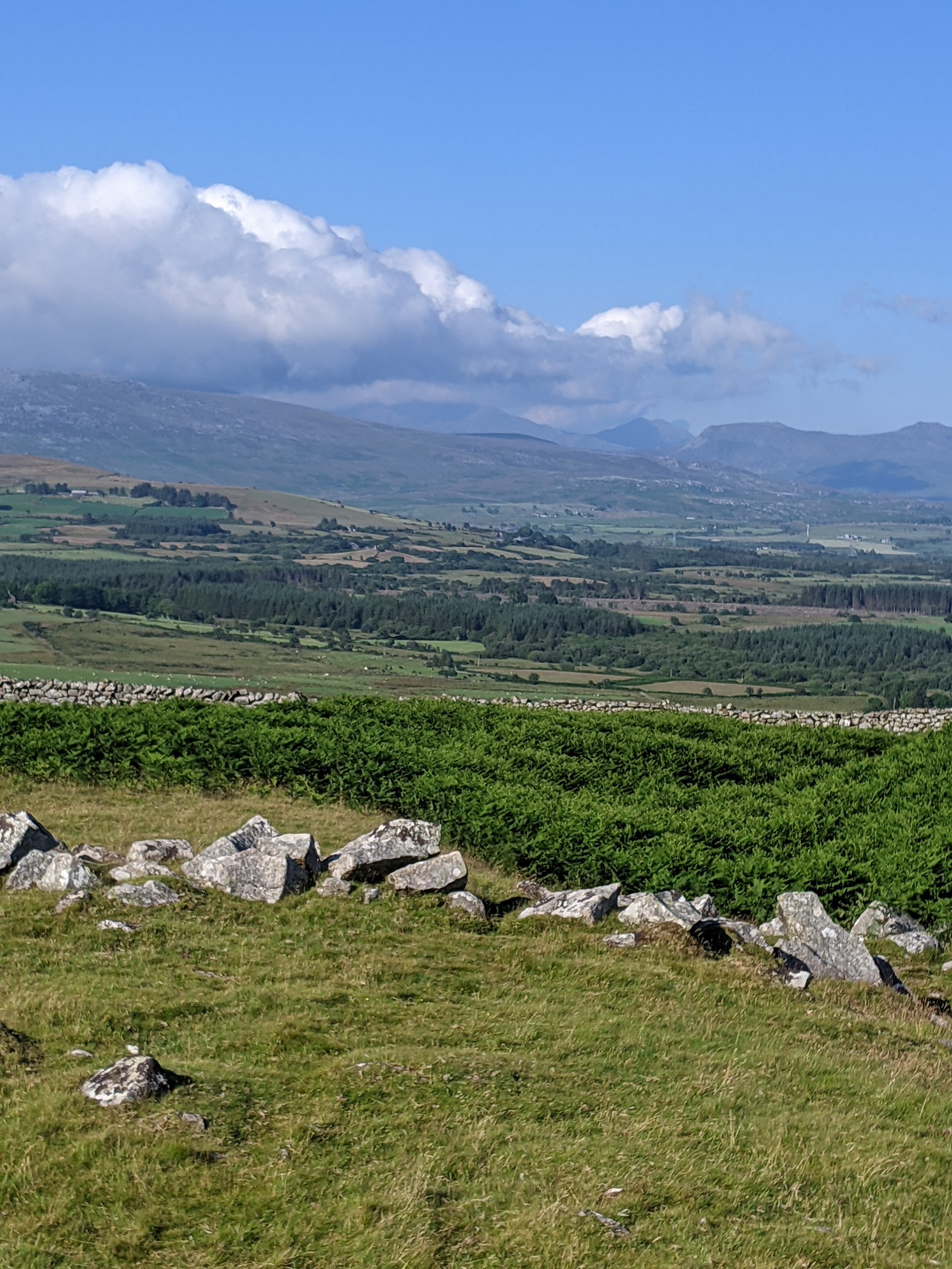
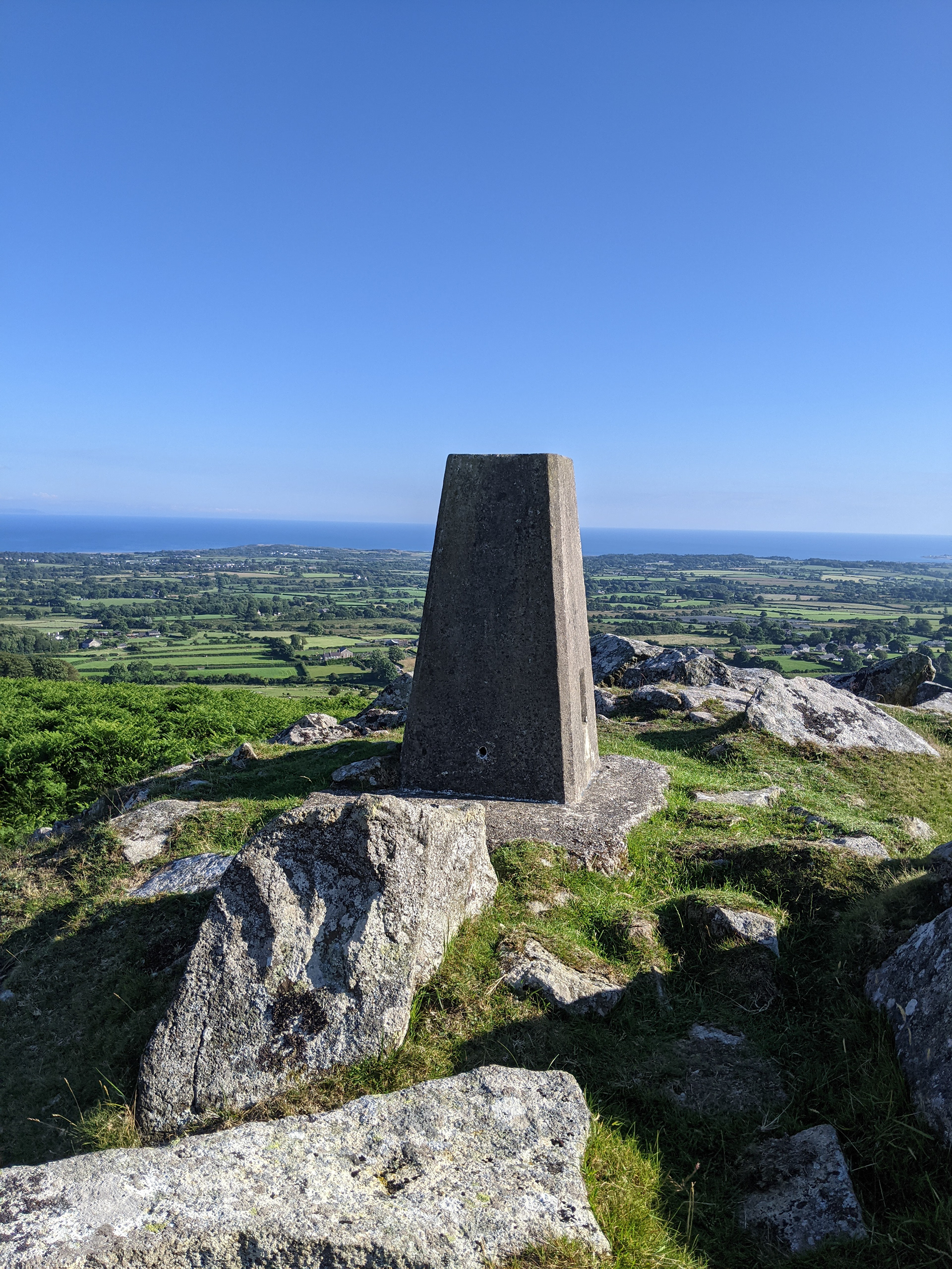
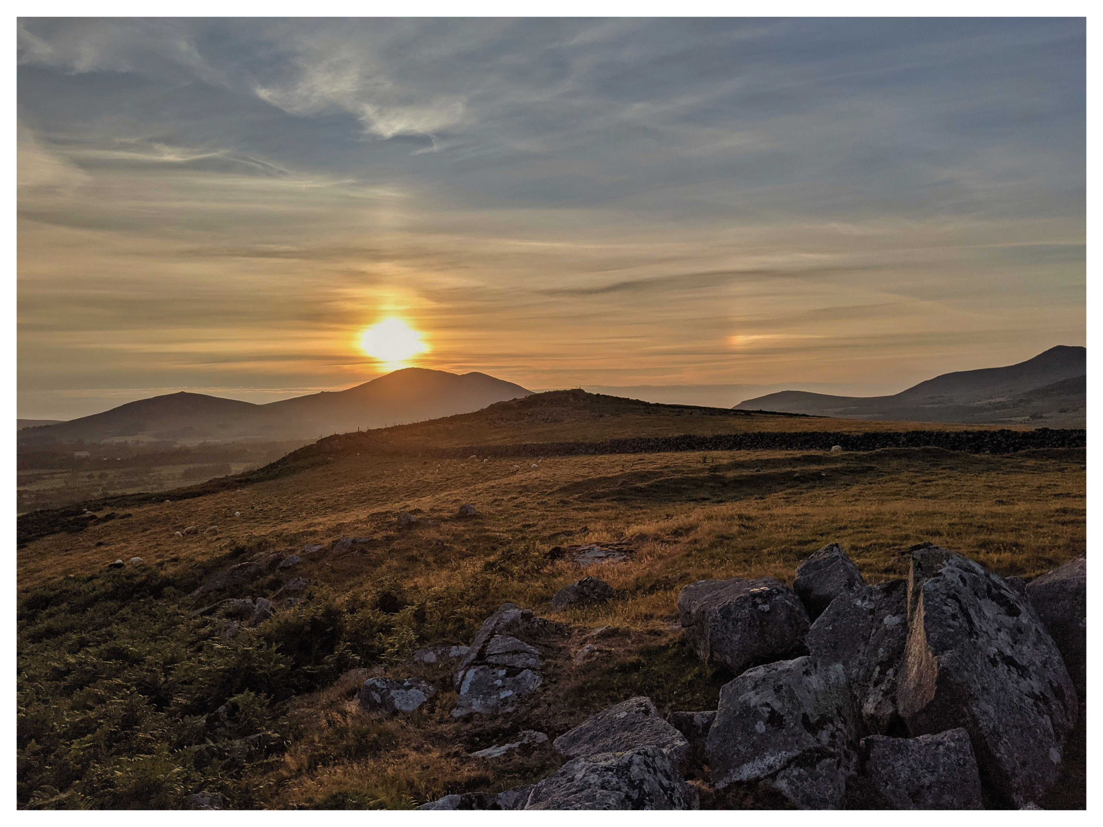
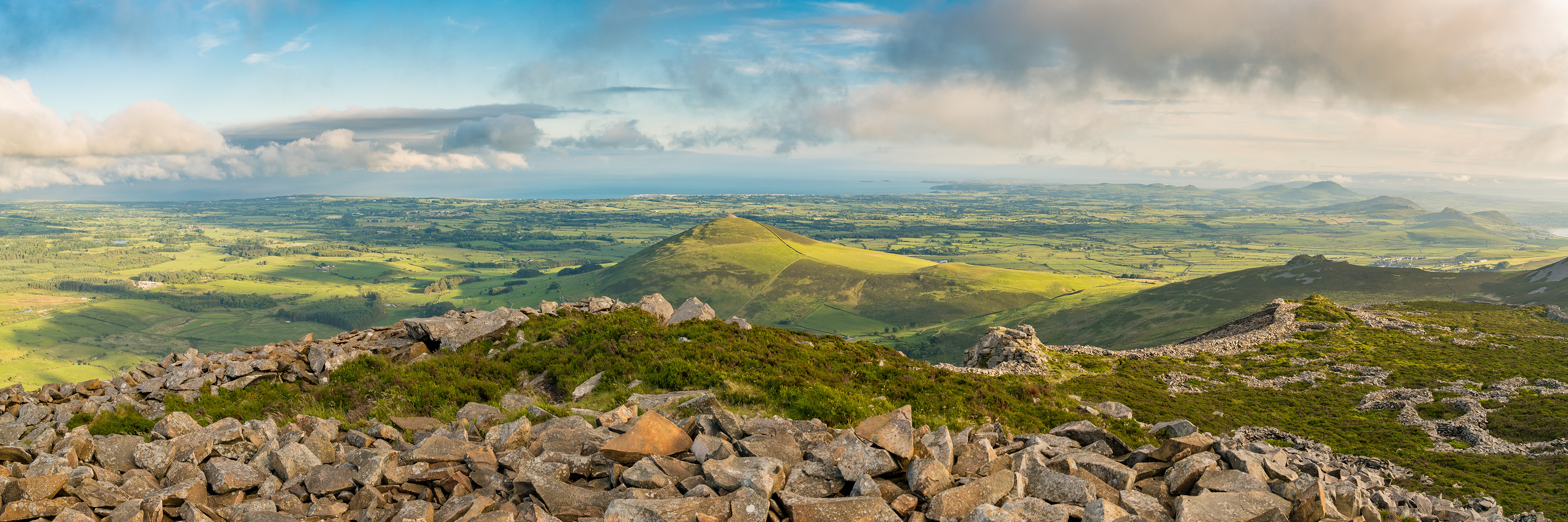
Garn Bentyrch is a hill which lies directly behind Bryn Aber Bach and can be clearly seen from the rear patio. Garn Bentyrch is 228 metres high with a prominence of 79 metres. On the top of the hill are the remains of a Neolithic fort. It's a relatively short walk to the top although the path is quite steep in places. Once at the summit the views are quite spectacular. Pwllheli and the Irish Sea lie to the south. To the north the peak of Yr Eifl is clearly visible and to the west the western peaks of the Snowdonia mountains rise up into the distance.
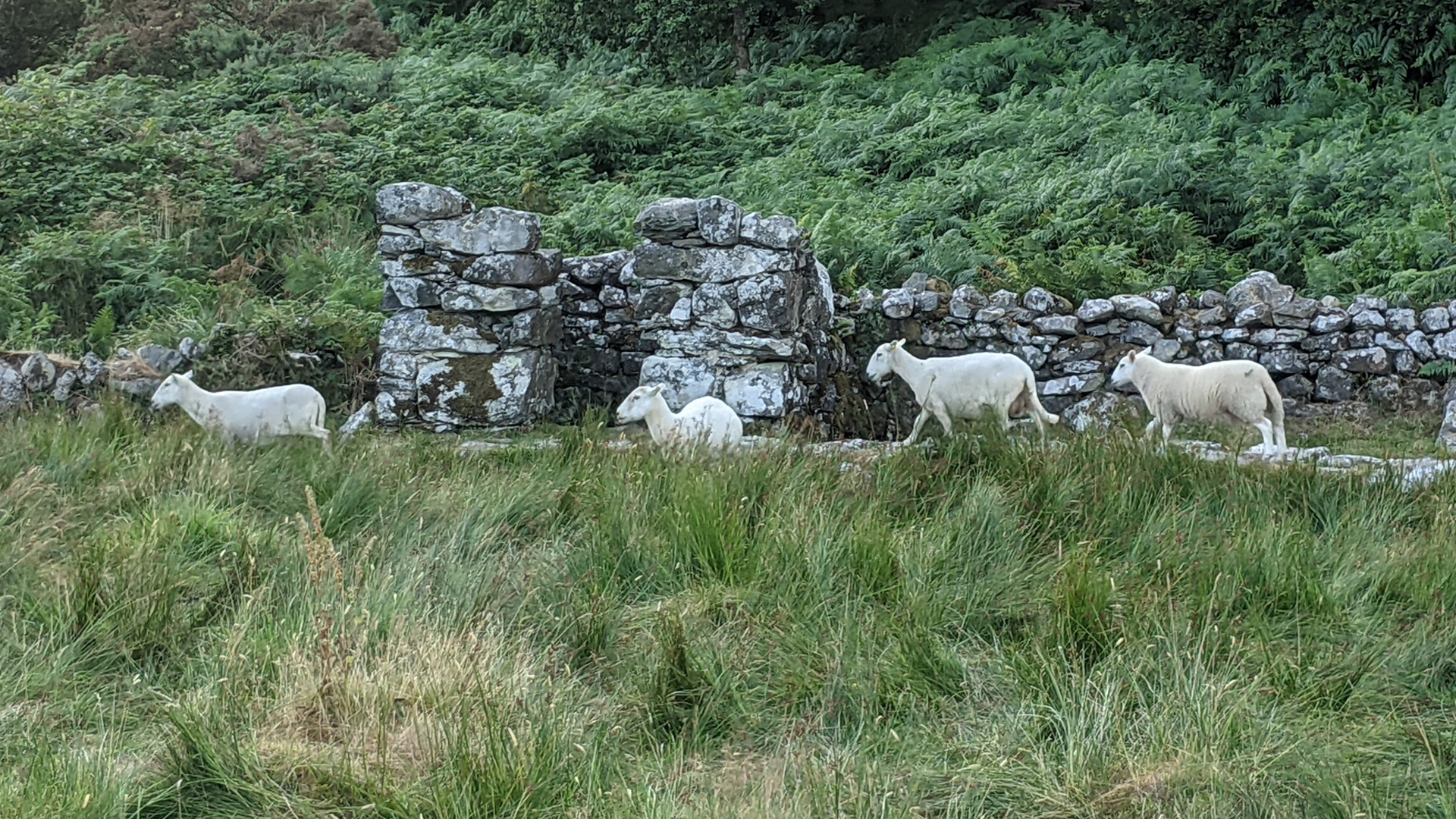
To reach Garn Bentyrch via the official footpath take the marked path to St. Cybi’s Well. The path carries on behind the Well and up through an ancient wood which is full of bluebells in the spring. At the top of the wood the path emerges into fields of sheep and the remains of the Neolithic fort can clearly be seen on the hilltop above. Continue up the path which runs along the dry stone wall to the right. This takes you up through a second field to the Trig Point. This spot affords some truly stunning views of the peninsula and beyond the mountains of Snowdonia